Not quite Scafell Pike: Wasdale

Aim of the experiment
To challenge our apparent need to get to the top (preferably the highest one), both in the fells and in life, through applying the literary cut-up technique to route design, and seeing where a more left-field approach might take us!
Background
This experiment was born during a visit to Wasdale, when two men in a pick-up truck stopped to ask me which one was the summit? Of course they meant Scafell Pike, but I wanted to answer - which summit? Wasdale is surrounded by spectacular peaks! Instead I dutifully pointed them in the right direction…and instead of spending the rest of the day feeling annoyed, I directed these feelings into designing a route which (whatever it did) was unlikely to ever reach the highest point in England, while setting out to all intents and purposes to do so!
The history of the cut-up technique goes back at least to the Dada poets and artists in the 1920s, but has become strongly associated with American author William Burroughs. Cut-up involves what it says on the tin: cutting up a piece of text and rearranging it in a random order - as a way of challenging existing meanings, and finding new (subconscious) meanings within. This experiment applies this technique to the instructions for climbing Scafell Pike from Wasdale, such that you might reach the summit, but it’s very unlikely (and what a great time we all had not doing so!)
Route instructions

The following route was created by taking the key instructional phrases from this route guide to climbing Scafell Pike from Wasdale Head, cutting them out, drawing them from a bag in random order, and thereby designing a new collaged hike. For safety reasons I planned this route out on the map rather than doing the experiment live. Please note that the below route - my first attempt at this experiment - is fairly extreme, and will be beyond the capabilities of most people. Please don’t attempt it unless you are confident and experienced in the fells, and have a very high level of fitness, since there is significant ascent, and even if the route does follow paths, these aren’t always obvious on the ground. The climb up to Dore Head is also exceptionally steep…If you are an experienced hiker and navigator (and only if), then you might design your own route by replicating my experiment. Otherwise, I plan to create a new route, which is accessible to far more people, over the coming weeks.

Click on the image to open an interactive version of the map on Viewranger,
or you can download the GPX file of my route here. (© OpenStreetMap contributors)
Route Grading: Extreme (12.5 miles & 6,324 feet of ascent)
Location: start at the parking area in the village green at Wasdale Head (see here on Google Maps).
Note (1): the route marked out on the GPX / map could be improved upon. I briefly lose the path around Kirk Fell at one point, and at the scrambly section of the climb up Piers Gill, I headed left over the rocks, whereas the main path bears right. My own alternatives are entirely safe, and there are faint paths, but I will return to ‘perfect’ the mapping as soon as I can.
Note (2): the following route instructions are an exact replica of what I composed following the experiment, and provide less detail than other routes in this guide. Please plot the route on a map clearly in advance.
From the parking area at the village green, walk back along the road towards the lake. Turn right to cross the Down-in-the-Dale bridge. Cross the river and turn right. Go through a field between the wall and the river and the Wasdale Head campsite. Beyond the campsite, in about 100m, go through a gate and continue up the Mosedale Beck footpath. Go through some more gates, with some waterfalls down to the RHS. Be aware that it’s a long way still to the summit of Scafell Pike! Nearing the end of the footpath up the valley, you will find a sheepfold - bear left here to climb the steep path up to Dore Head. Continue on the path along the ridge to Red Pike. Keep right at the junction of paths up ahead, skirting beneath the summit of Scoat Fell rather than going to the summit. Go through Windy Gap and continue across the ascending boulder fields ahead to reach the summit of Pillar. In 200m, at the edge of the cliff ahead, the fell drops off to Pillar Rock and Ennerdale. Don’t take the climber’s path ahead. Instead, turn right to head down towards the col with Kirk fell. Follow the path across Looking Stead. Drop down to Black Sail pass. Bear left to join the path from Beckhead which skirts around the side of Kirk Fell. Make sure you pick up the faint trod, as it begins to climb back up to the pass before Great Gable. Use the easy path to your RHS which begins to descend to Wasdale Head (nb it’s not actually that easy - it’s very steep!) Come down the path which contours beneath the needles to turn right down the nose of Great Gable. Take a quite definitive left turn at the bottom to head back up towards Styhead Tarn on the Moses Trod path. Cross the branch of the river, having kept left to follow the river uphill. Continue on the path beyond the path junction which continues up Piers Gill. Continue beyond the end of the gill where the path meets the Corridor Route. As you approach, but never quite reach, Scafell Pike (honest to goodness, this route note came up right at this moment), bear right on the Corridor route to Lingmell Col. Very shortly after the col, turn right on a runner’s trod which skirts around to the nose of Lingmell (without going to the summit). Follow the ridge back downhill to a gate where you will turn right on a rough trod that leads to a bridge across the river. Cross the field ahead, and turn right at the road back to your car.
Route adaptation for walk-from-home

This experiment, of cutting a route into pieces, and putting it back together differently, can be done with any route description. If there are no route descriptions to your favourite walk-from-home, then why not write one yourself, and cut this up, to see where the rearranged directions take you (it might make your daily morning dog walk, or the run you’ve got into the habit of doing, more interesting!) It can equally easily be done in an urban setting. Why not write down your usual route to work, cut this up and reorder it, and see where you end up. Maybe not actually on a work day…! Please don’t complete this exercise unless you are confident with maps and route-finding (or have a sympathetic boss…)
Writing & Art Ideas, & Virtual Alternatives
Writing
Take the fragments of route instructions in the same order as you drew them from the hat, and use the instructions as the starting points for lines of writing (filling in the gaps). In other words, if you had an instruction which started: Take…then there are any number of ways you might finish this phrase / line / sentence (Take two. Take my hand. Take your medicine before bed….) Once you have completed one phrase, move on to the next. Do this exercise really quickly, thinking as little as possible, in order to achieve that same sense of strangeness that characterises the above route! You might like to do this writing before going on the hike, and to take your piece of writing with you (to see how the hike changes it, and how the writing changes the hike). Or you might prefer to do the hike first, and to see whether your experiences actually affect what you write (don’t try to make this the case though, or you will overthink things). Or perhaps the two experiences will actually stand apart from each other…my own poem below outlines a very different imaginary experience to the one I had on the fell, but strangely they still speak to each other.
Visual art
There’s only one rule: you are allowed to take photographs or make sketches of any part of this route, so long as the image doesn’t include the summit of Scafell Pike! It’s harder to obey than you might think…
Virtual exercise
The writing exercise for this route can straightforwardly be done without doing the walk - they are two separate exercises. You could also do the writing part of the experiment with a route you remember completing recently, removing the key instructional phrases and using these as the starting point for sentences / lines.

My own poetry
A day out with the day
It began at the grassy car-park
in the village green.
I wanted to treat the day ahead
with a day out. All of its own.
So we walked along the Wasdale valley
together towards the sea, turned left when
she asked to cross the road.
This way? Sellafield.
The other? The end of every Cumbrian
road. And that way leads back home.
I wanted to raise the consequences
of tomorrow, but she wasn’t up for that.
Today was for her, and was her, and wasn’t
going to be her, right enough, forever.
I said, for want of knowing her any better:
be aware of gossipmongering sunshine.
She said: bear me children, and continue.
In 200m, at the edge of our peripheral vision,
the world dropped off the side of itself more
dramatically even than yesterday.
We didn’t choose that path
and it didn’t choose us either.
Instead we turned our heads towards each
other, as if to kiss, and follow through.
The mood dropped lower than the tide line
on the pebbled beach that we’d arrived upon.
We had no ice creams.
And no umbrella with whose tip to pierce
the approaching front of weather either.
Bear up, she said. And use the easy way.
The come-down will be like nothing else,
and nothing more.
A definitive view of now I couldn’t quite
unhandle. Crossing all the roads and bridges
when you continue them?
She stepped into the sea, then, and asked
me if I’d join her. I shook my head, and mumbled
my goodbyes. Later on, today, she’d be America’s.
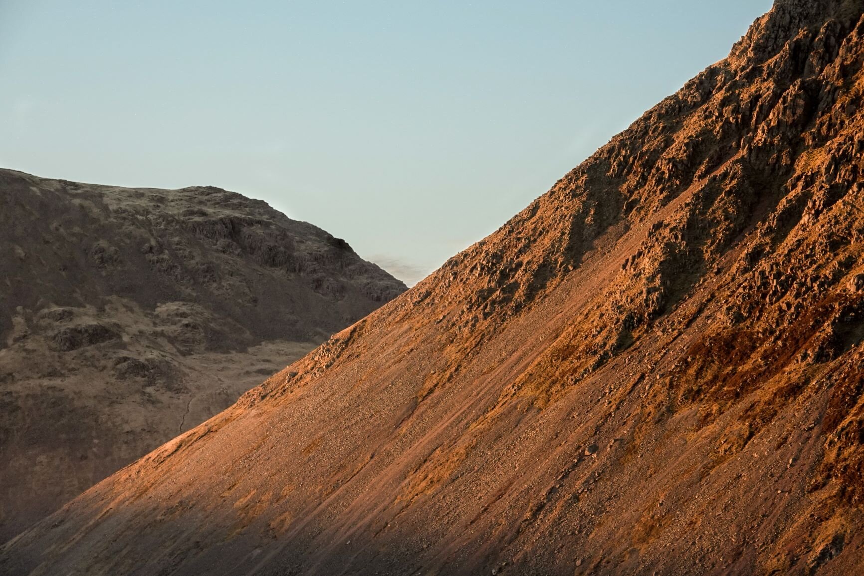
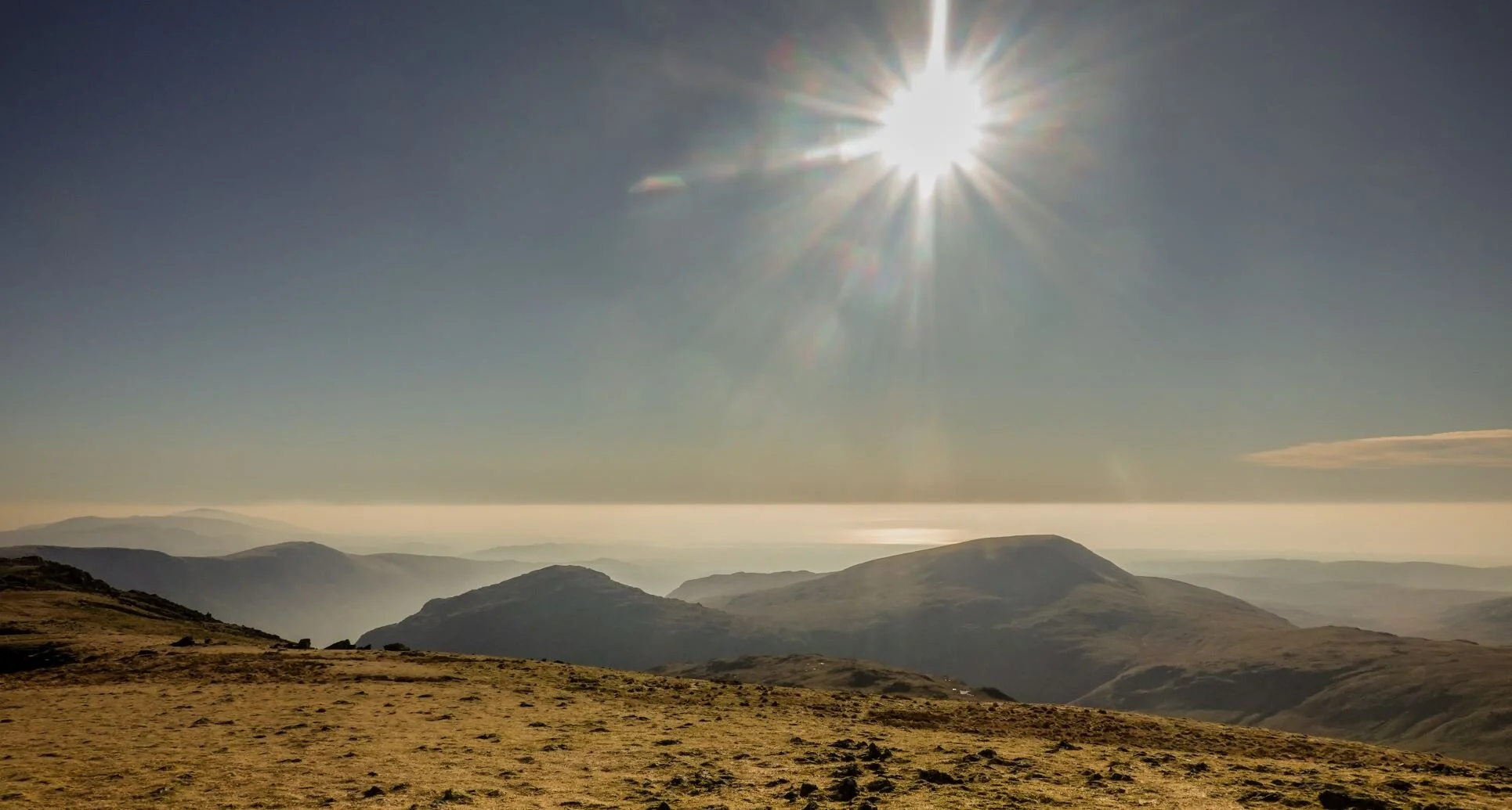
Gallery
My own photographs of not-quite-Scafell-Pike are illustrated on this page. The question is, are they better pics or worse ones than the following sneaky pic which the highest fell in England sneaked its way into?! And what does it say that I couldn’t help myself? There are more photos of this route in my blog piece 'All the best laid plans,’ taken during an ill-fated attempt to make good the small route imperfections mentioned above, on a day which turned out to have the most spectacular cloud and light combinations, even if all didn’t go to plan otherwise!
